Morphing Cartesian to Polar Coordinates


Requires a Wolfram Notebook System
Interact on desktop, mobile and cloud with the free Wolfram Player or other Wolfram Language products.
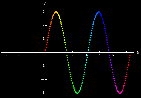
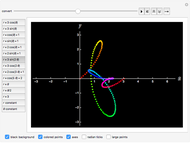
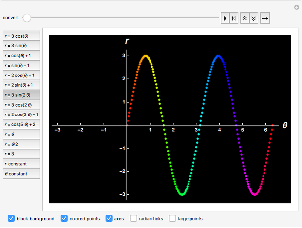
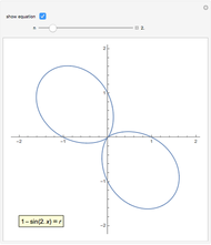
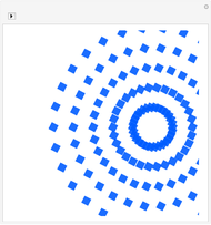
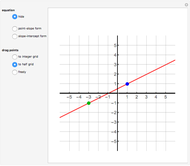
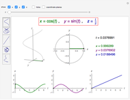
This Demonstration helps you visualize how a rectangular graph becomes a polar graph. Given a function  , each point
  is initially graphed in a
  -
- plane using a rectangular coordinate system. The points are then moved along linear paths to their corresponding polar locations in the
  -
- plane. Colors help indicate which points end up where and how the relative extrema become extrema in the polar graph. Constant
  and constant
  illustrate how the rectangular grid becomes a polar grid.
Contributed by: Abby Brown (January 2018)
Suggested by: Joshua Hornilla
Open content licensed under CC BY-NC-SA
Snapshots


Details
detailSectionParagraphPermanent Citation
"Morphing Cartesian to Polar Coordinates"
http://demonstrations.wolfram.com/MorphingCartesianToPolarCoordinates/
Wolfram Demonstrations Project
Published: January 10 2018
 The Polar Equations of Hearts and Flowers
Michael Croucher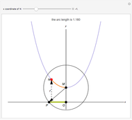 Arc Length of the Hyperbolic Cosine
Bernard Vuilleumier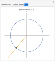 Constant Coordinate Curves for Parabolic and Polar Coordinates
Peter Falloon Constant Coordinate Curves for Elliptic Coordinates
Peter Falloon Limaçons as Loci and Other Polar Curves
Roberta Grech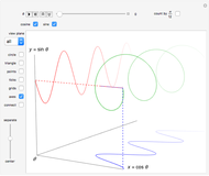 Sine and Cosine Helix
Abby Brown A Library of Functions with Transformations
Ed Zaborowski Frequency Chord Projection
Michael Schreiber Guilloché Outline Rules
Michael Schreiber Guilloché Patterns
Michael Schreiber
-
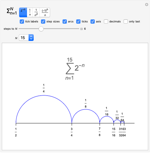 Series: Steps on a Number Line
Abby Brown -
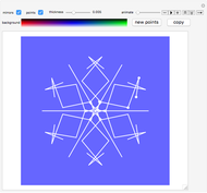 Snowflake Designs
Abby Brown -
 Morphing Cartesian to Polar Coordinates
Abby Brown -
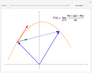 Derivative of a Vector-Valued Function in 2D
Abby Brown -
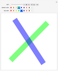 Spinning Action
Abby Brown -
 Fireworks with Regular Polygon and Circle Points
Abby Brown -
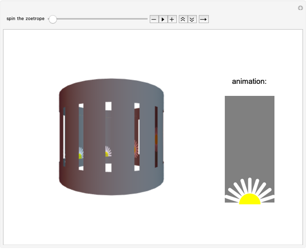 3D Zoetrope
Abby Brown -
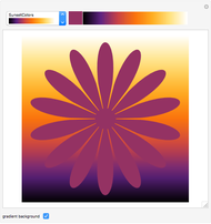 Color Gradient Sliders
Abby Brown -
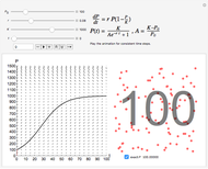 Logistic Model for Population Growth
Abby Brown -
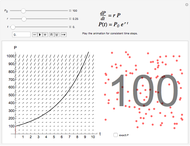 Exponential Model for Population Growth
Abby Brown -
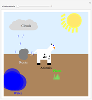 The Phosphorus Cycle
Abby Brown -
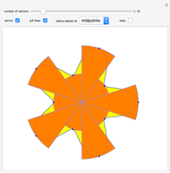 Approximating Polar Area with Sectors
Abby Brown -
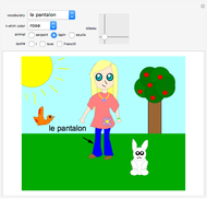 Let's Learn French! An Interactive Learning Game
Abby Brown -
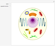 Animal Cell Structure
Abby Brown -
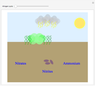 The Nitrogen Cycle
Abby Brown -
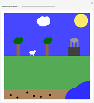 The Carbon Cycle
Abby Brown -
 Lines: Two Points
Abby Brown -
 Parametric Curves in 3D
Abby Brown -
Sine and Cosine Helix
Abby Brown -
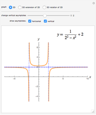 Examples of Asymptotes in 2D and 3D
Abby Brown